The Valencia Community has a lot of hiking routes in Valencia and some of them lead us to spectacular places in Valencian geography. Hiking in Valencia can be practiced in a flat area such as the Albufera or you can get into where the mountaineering in Valencia takes place between ravines and peaks.
The province is part of the European Network of Long-Distance Trails, which connects different regions of Europe on foot.
Two great European paths cross the Valencian mountains. It crosses the province from north to south and from east to west. The trails are called GR-7, which links Gibraltar and the Peloponnese, and the GR-10, which connects the Atlantic (Lisbon) with the Mediterranean (Puçol), also indicate the GR-37, which runs through the High Valencian Mountains.
We propose you three areas to make your hiking route in Valencia as:
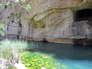
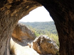
Chulilla: Puentes colgantes-Pinturas rupestres-Barranco de Vallfiguera-Charco Azul (IBP 59 HKG)
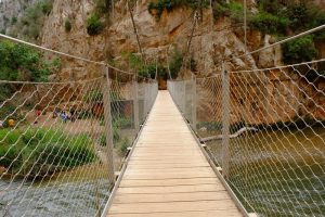
The route of Los Calderones-Hoces del Turia has become very popular after the installation, at the end of 2012, of two hanging bridges with a wooden base and steel braces, which allow us to pass from one bank to another of the Turia, in a stretch of the river that runs straight between the reservoir of Loriguilla and the vicinity of the Barranco de la Cueva.
During weekends, the route is very busy, although most groups make a round trip, from the parking lot to the reservoir of Loriguilla, with a distance of about eight kilometers. There is a circular route that, in addition to the sickles, allows you to visit the cave paintings of the Vallfiguera ravine and, on your return, make the botanical route along the Turia riverbank (SL-CV 74) to the Blue puddle and, from this point , link with the parking.
Calles-Peña Cortada-Acueducto Romano-Chelva and Ruta del Agua
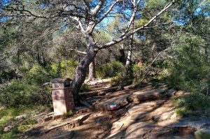
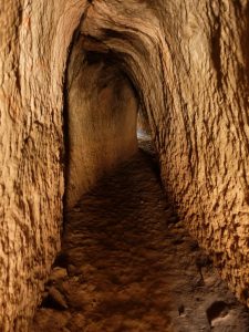
Magnificent circular hiking route located in the ‘Comarca de los Serranos’. You will leave from the town of Calles and you will pass through excellent narrows and an opulent ‘Peña Cortada’, where you will penetrate the tunnels of a Roman viaduct. «Several Skylights will make indispensable the torches or frontals». Then you will cross a superb Roman Aqueduct, which you will never forget. You will walk on a path from PR-CV92 to the town of Chelva, crossing the east face and the Moorish and Jewish neighborhood of this town. You will go down to the Tuejar River to start the popular ‘Ruta del Agua’ (Recommended river shoes for the more intrepid ones who want to cool off or bath). Parallel to the river you will follow the course of it and you will enjoy a beautiful and enchanting section full of vegetation and color, which will give a special touch to the route. You will also pass through an old Light Factory, cross the Tuejar River and finally along a path parallel to the river you will return to the town of Calles, where you can take a snack and enjoy its charming surroundings.
Cruz del Sierro from la Font del Marionet
This route is more easy than it seems, it is true that has some other complicated stage but has no great difficulty unless you have to go around and climbing stones but not much stretch, as for the rest of the climb to the Cruz del Sierro does not have large ramps.
It is a climb that goes on little by little, and at the top of the Cruz del Sierro you will descend along a very wide track, and at the base you will cross two ravines, on the right is to go to L’Oronet Restaurant next to the Cv-310 road, but on this time you will turn off to the left to look for the descent to the ravine of Serra to Tristan, before joining that ravine you will add a part of trails / rills and then you will dare with this ravine to descend practically until Serra but before reaching this town you will turn left to go again inside the ravine dels Tramussos and from here to the beginning of the Track.